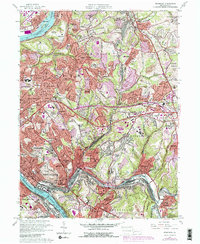
1953 Map of Braddock
USGS Topo · Published 1955About this map
Industrial valleys and dense residential ridges define this portion of Allegheny County during the mid-1950s. The heavy industrial corridor along the Monongahela River anchors the south, where the Pennsylvania RR and Union RR serve the sprawling works of Braddock, North Braddock, and Duquesne. To the north, the landscape transitions into the steep hills of Penn Hills and Monroeville, where postwar suburban expansion is visible in developments like Laketon Heights and Eastwood. Local community life is centered around numerous neighborhood institutions, from Turtle Creek High Sch to the Municipal Bldg in Wilmerding. Notable recreation and landmark sites include Kennywood Amusement Park near the river bend and the high-altitude Radio Tower (KDKA) on the western ridge. This survey also records several large cemeteries, such as Monongahela Cem and Restland Memorial Park Cemetery, providing essential data for local genealogical research.
Find a feature on this map
88 named features on this map. Tap any name to fly to it.
Don’t see what you’re looking for? This feature index may not catch every label — zoom into the map to look around manually.
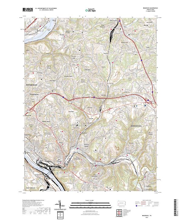
Map Details
Editions of this 1953 Braddock Map
This is the sole edition of this map. No revisions or reprints were ever made.
Historical Maps of Pittsburgh Through Time
3 maps found