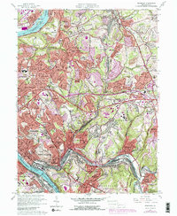
1960 Map of Braddock
USGS Topo · Published 1979About this map
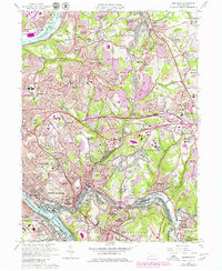
Industrial development and dense residential expansion define this landscape where the Monongahela River meets the Allegheny River valley. The map documents the complex infrastructure of the steel era, showing major transport corridors like the Conrail and Pittsburgh and Lake Erie railroads serving heavy industrial zones marked by a Slag Dump. Above the riverfront hubs of Braddock and Duquesne, the terrain rises into residential enclaves such as Churchill, Eastmont, and Shannon Heights. The presence of numerous parochial institutions, including St Bartholomew Ch and St Robert Bellarmine Ch, alongside several golf courses like Edgewood Country Club, illustrates the mid-century suburbanization of the hills surrounding the urban core. Local history is deeply etched into the landscape via family and memorial landmarks like Woodlawn Cemetery and Restland Memorial Park (Cemetery).
Find a feature on this map
119 named features on this map. Tap any name to fly to it.
Don’t see what you’re looking for? This feature index may not catch every label — zoom into the map to look around manually.
Map Details
Editions of this 1960 Braddock Map
5 editions found
Other maps of this area

1904 · Mc Keesport
USGS Topo · 1:62,500

1904 · Greensburg
USGS Topo · 1:62,500

1906 · Greensburg
USGS Topo · 1:62,500

1907 · Pittsburg
USGS Topo · 1:62,500

1907 · Freeport
USGS Topo · 1:62,500

1908 · New Kensington
USGS Topo · 1:62,500

1909 · Freeport
USGS Topo · 1:62,500

1910 · New Kensington
USGS Topo · 1:62,500

1951 · Pittsburg East
USGS Topo · 1:24,000

1953 · Pittsburgh
USGS Topo · 1:250,000