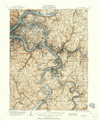
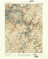
1953 Map of Pittsburgh
USGS Topo · Published 1953About this map
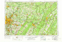
The Allegheny River, Ohio River, and Monongahela River converge at the industrial heart of Pittsburgh, anchoring a dense network of steel towns and rail hubs. Moving east across the Allegheny Plateau, the landscape transitions into the sharp ridges of the Allegheny Mountains, where the Pennsylvania Turnpike cuts through the terrain. The map captures a post-war industrial peak for cities like Altoona and Johnstown, showing the complex relationship between the region's heavy manufacturing centers and the rugged topography of Laurel Hill and Chestnut Ridge.
Find a feature on this map
70 named features on this map. Tap any name to fly to it.
Don’t see what you’re looking for? This feature index may not catch every label — zoom into the map to look around manually.
Map Details
Editions of this 1953 Pittsburgh Map
This is the sole edition of this map. No revisions or reprints were ever made.
Historical Maps of Pittsburgh Through Time
7 maps found