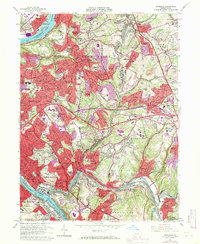
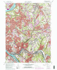
1960 Map of Braddock
USGS Topo · Published 1971About this map
The confluence of heavy industry and suburban expansion defines this landscape along the Monongahela River and Allegheny River. While traditional rail-and-river transport remains central, with the Penn Central and Baltimore and Ohio railroads tracing the valleys, the 1969 revisions highlight the rapid growth of communities like Monroeville and Garden City. Institutional landmarks such as the Gateway High Sch and the East Pittsburgh Airport appear alongside older religious sites like the Beulah Ch and Hebron Cem.
Find a feature on this map
142 named features on this map. Tap any name to fly to it.
Don’t see what you’re looking for? This feature index may not catch every label — zoom into the map to look around manually.
Map Details
Editions of this 1960 Braddock Map
5 editions found
Other maps of this area

1904 · Mc Keesport
USGS Topo · 1:62,500

1904 · Greensburg
USGS Topo · 1:62,500

1906 · Greensburg
USGS Topo · 1:62,500

1907 · Pittsburg
USGS Topo · 1:62,500

1907 · Freeport
USGS Topo · 1:62,500

1908 · New Kensington
USGS Topo · 1:62,500

1909 · Freeport
USGS Topo · 1:62,500

1910 · New Kensington
USGS Topo · 1:62,500

1951 · Pittsburg East
USGS Topo · 1:24,000

1953 · Pittsburgh
USGS Topo · 1:250,000