Loading...
Loading map...2024 Map of Bradley
USGS Topo · Published 2024About this map
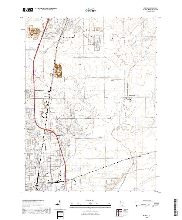
The northern edge of Kankakee and the growing corridors of Bradley and Bourbonnais dominate this 2024 landscape. The map illustrates a dense educational and institutional footprint, notably the Olivet Nazarene University campus and the Trend Setters College of Cosmetology. Local history is anchored by the Mound Grove Cem and the State of Illinois Veterans Home-Cem near Manteno, reflecting the long-standing community services in the region.
Find a feature on this map
32 named features on this map. Tap any name to fly to it.
Don’t see what you’re looking for? This feature index may not catch every label — zoom into the map to look around manually.
Map Details
Date Portrayed2024
Date Published2024
PublisherU.S. Geological Survey
Map TypeTopographic
Scale1:24000
Physical Dimensions24 x 29 inches
Editions of this 2024 Bradley Map
This is the sole edition of this map. No revisions or reprints were ever made.
Historical Maps of Exline Through Time
Featured Locations
Source Details
SourceU.S. Geological Survey
CopyrightPublic Domain