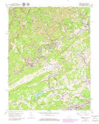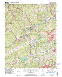
2023 Map of Bramwell
USGS Topo · Published 2023About this map
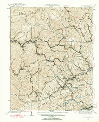
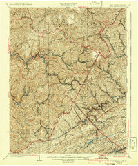
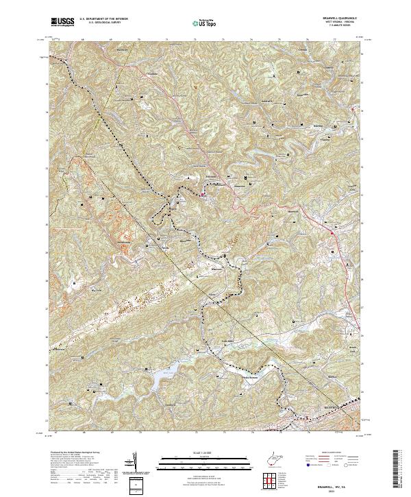
Bramwell and its neighboring coalfield settlements sit at the heart of this landscape straddling the West Virginia and Virginia border. The map documents a dense network of valley communities including Pocahontas, Maybeury, and Montcalm, many of which are connected by the historic Coal Heritage Rd. The terrain is characterized by steep ridges and narrow hollows like Angle Hollow and Booths Hollow, forcing development into tight corridors along the Bluestone River and Elkhorn Creek. Local genealogists will find an exceptional density of family and community burial grounds, such as Bryant Memorial Cem, Pocahontas Cem, and Mount Tabor Cem. Significant natural and engineered features include the prominent Pinnacle Rock and the waters of Falls Mills Lake, which dominate the southern portion of the survey near the Mercer and Tazewell county line.
Find a feature on this map
137 named features on this map. Tap any name to fly to it.
Don’t see what you’re looking for? This feature index may not catch every label — zoom into the map to look around manually.
Map Details
Editions of this 2023 Bramwell Map
This is the sole edition of this map. No revisions or reprints were ever made.
Historical Maps of Yards Through Time
5 maps found