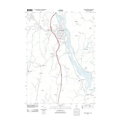
2012 Map of Brattleboro
USGS Topo · Published 2012About this map
Brattleboro serves as the hub of this region where the West River joins the Connecticut River, a landscape defined by significant elevation changes and deep-rooted community landmarks. The map documents the dense network of historic burial sites that reflect early settlement patterns, including Meetinghouse Hill Cem, Saint Michaels Cem, and the Brattleboro Area Jewish Cem. Cultural features such as the Creamery Covered Bridge and the Brattleboro Retreat Tower stand as distinct markers of local heritage, while Living Memorial Park Ski Area highlights the area's recreational use of the upland terrain. To the south, the village of Guilford and the hamlet of North Vernon are connected by Interstate 91, which bisects the valley. The presence of Miller's Pleasure Airfield near the river bank indicates the continued utility of the flatlands along the Connecticut River for local aviation.
Find a feature on this map
180 named features on this map. Tap any name to fly to it.
Don’t see what you’re looking for? This feature index may not catch every label — zoom into the map to look around manually.
Map Details
Editions of this 2012 Brattleboro Map
This is the sole edition of this map. No revisions or reprints were ever made.
Other maps of this area

1887 · Warwick
USGS Topo · 1:62,500

1889 · Warwick
USGS Topo · 1:62,500

1890 · Greenfield
USGS Topo · 1:62,500

1891 · Brattleboro
USGS Topo · 1:62,500

1893 · Brattleboro
USGS Topo · 1:62,500

1894 · Greenfield
USGS Topo · 1:62,500

1894 · Warwick
USGS Topo · 1:62,500

1898 · Keene
USGS Topo · 1:62,500

1932 · Brattleboro
USGS Topo · 1:48,000

1932 · Warwick
USGS Topo · 1:48,000