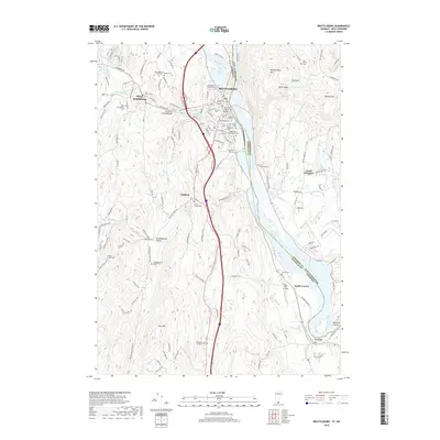
2018 Map of Brattleboro
USGS Topo · Published 2018About this map
Brattleboro and its neighboring villages serve as the anchor for this corner of Vermont, where the West River joins the Connecticut River. The landscape is a dense network of early settlement sites, indicated by a remarkable number of local burial grounds such as Meetinghouse Hill Cem and Dalem Cem. In West Brattleboro, the Creamery Covered Bridge stands as a landmark of regional engineering. The map reveals the varied development of the valley, from the historic Brattleboro Retreat Cem near the town center to the Miller Farm Airfield further south in North Vernon. Across the river in New Hampshire, the terrain rises sharply toward Wantastiquet Mtn and Daniels Mtn, overlooking the agricultural flats of Guilford and the narrow valley of Weatherhead Hollow.
Find a feature on this map
142 named features on this map. Tap any name to fly to it.
Don’t see what you’re looking for? This feature index may not catch every label — zoom into the map to look around manually.
Map Details
Editions of this 2018 Brattleboro Map
This is the sole edition of this map. No revisions or reprints were ever made.
Other maps of this area

1887 · Warwick
USGS Topo · 1:62,500

1889 · Warwick
USGS Topo · 1:62,500

1890 · Greenfield
USGS Topo · 1:62,500

1891 · Brattleboro
USGS Topo · 1:62,500

1893 · Brattleboro
USGS Topo · 1:62,500

1894 · Greenfield
USGS Topo · 1:62,500

1894 · Warwick
USGS Topo · 1:62,500

1898 · Keene
USGS Topo · 1:62,500

1932 · Brattleboro
USGS Topo · 1:48,000

1932 · Warwick
USGS Topo · 1:48,000