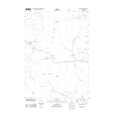
2012 Map of Bread Loaf
USGS Topo · Published 2012About this map
Middlebury Summer College and the surrounding wilderness of the Green Mountains define this portion of Vermont. This area, centered on the historic settlement of Bread Loaf, shows a landscape where high-altitude education and recreation meet. Significant terrain features such as Worth Mountain and Battell Mountain tower over the S Br Middlebury River valley, while the Middlebury College Snow Bowl marks a pocket of development amidst the forest. For genealogists and local historians, several small burial grounds are preserved here, including Kirby Cem and Mazham Cem. The map traces a network of trails and backcountry shelters like Skylight Lodge and Pleiad Shelter, illustrating the long-standing tradition of mountain travel through Middlebury Gap and along the Pine Brook Trl.
Find a feature on this map
65 named features on this map. Tap any name to fly to it.
Don’t see what you’re looking for? This feature index may not catch every label — zoom into the map to look around manually.
Map Details
Editions of this 2012 Bread Loaf Map
This is the sole edition of this map. No revisions or reprints were ever made.
Other maps of this area

1902 · Brandon
USGS Topo · 1:62,500

1903 · Middlebury
USGS Topo · 1:62,500

1904 · Brandon
USGS Topo · 1:62,500

1905 · Middlebury
USGS Topo · 1:62,500

1915 · Rochester
USGS Topo · 1:62,500

1917 · Rochester
USGS Topo · 1:62,500

1919 · Lincoln Mountain
USGS Topo · 1:62,500

1920 · Lincoln Mountain
USGS Topo · 1:48,000

1920 · Brandon
USGS Topo · 1:62,500

1920 · Middlebury
USGS Topo · 1:62,500