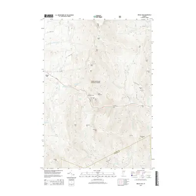
2015 Map of Bread Loaf
USGS Topo · Published 2015About this map
The Green Mountain National Forest dominates this section of the Vermont interior, where the high ridges of the Green Mountains form a dramatic backdrop for the community of Bread Loaf. This area is defined by its steep terrain and significant gaps, such as Middlebury Gap and Texas Gap, which have historically dictated the paths of travel through the range. Researchers will find a landscape carved by numerous watercourses, including the White River and the Middle Br Middlebury River, alongside several high-elevation features like Pleiad Lake and Skylight Pond. The map reveals the persistence of local family names and small settlements through sites such as Kirby Cem and Lewis Cem, while the Natural Tpke and Ripton 125 provide the primary corridors through the dense forest and over the mountain passes.
Find a feature on this map
60 named features on this map. Tap any name to fly to it.
Don’t see what you’re looking for? This feature index may not catch every label — zoom into the map to look around manually.
Map Details
Editions of this 2015 Bread Loaf Map
This is the sole edition of this map. No revisions or reprints were ever made.
Other maps of this area

1902 · Brandon
USGS Topo · 1:62,500

1903 · Middlebury
USGS Topo · 1:62,500

1904 · Brandon
USGS Topo · 1:62,500

1905 · Middlebury
USGS Topo · 1:62,500

1915 · Rochester
USGS Topo · 1:62,500

1917 · Rochester
USGS Topo · 1:62,500

1919 · Lincoln Mountain
USGS Topo · 1:62,500

1920 · Lincoln Mountain
USGS Topo · 1:48,000

1920 · Brandon
USGS Topo · 1:62,500

1920 · Middlebury
USGS Topo · 1:62,500