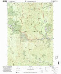
1997 Map of Bread Loaf
USGS Topo · Published 2000About this map
Breadloaf Wilderness and the Green Mountain National Forest dominate this landscape, centered on the high ridges and deep gaps of the central Green Mountains in the late 1990s. The map captures the intersection of outdoor recreation and literary history, particularly around the settlement of Bread Loaf and the Robert Frost Memorial Drive. The presence of the Middlebury College Snow Bowl, Worth Mountain Lodge, and several hikers' refuges like Skyline Lodge Shelter and Boyce Shelter along the Long Trail illustrates the era's established trail and alpine skiing infrastructure.
Find a feature on this map
63 named features on this map. Tap any name to fly to it.
Don’t see what you’re looking for? This feature index may not catch every label — zoom into the map to look around manually.
Map Details
Editions of this 1997 Bread Loaf Map
This is the sole edition of this map. No revisions or reprints were ever made.
Other maps of this area

1902 · Brandon
USGS Topo · 1:62,500

1903 · Middlebury
USGS Topo · 1:62,500

1904 · Brandon
USGS Topo · 1:62,500

1905 · Middlebury
USGS Topo · 1:62,500

1915 · Rochester
USGS Topo · 1:62,500

1917 · Rochester
USGS Topo · 1:62,500

1919 · Lincoln Mountain
USGS Topo · 1:62,500

1920 · Lincoln Mountain
USGS Topo · 1:48,000

1920 · Brandon
USGS Topo · 1:62,500

1920 · Middlebury
USGS Topo · 1:62,500