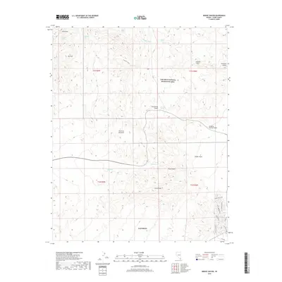
2018 Map of Bridge Canyon
USGS Topo · Published 2018About this map
Laughlin and the surrounding desert landscape of Clark County are defined by sharp topographical relief and vital water sources in this 2018 survey. The terrain transitions from the Mojave Desert floor into the high elevations of the Newberry Mountains, where landmarks like Little Peak and Conical Peak rise above the drainage networks. A network of springs, including Hiko Springs, Quail Spring, and Moss Spring, provided historical points of survival and settlement in this arid environment. Significant portions of the land are protected within the Lake Mead National Recreation Area, which preserves the dramatic geology of Bridge Canyon and Grapevine Canyon. The southern edge of the map shows the modern expansion of Laughlin, with suburban developments such as James A Bilbray Pkwy and Cottage Canyon St pressing against the wilderness.
Find a feature on this map
32 named features on this map. Tap any name to fly to it.
Don’t see what you’re looking for? This feature index may not catch every label — zoom into the map to look around manually.
Map Details
Editions of this 2018 Bridge Canyon Map
This is the sole edition of this map. No revisions or reprints were ever made.
Other maps of this area

1886 · Camp Mohave
USGS Topo · 1:250,000

1892 · Camp Mohave
USGS Topo · 1:250,000

1926 · Mohave City
USGS Topo · 1:96,000

1942 · Camp Mohave
USGS Topo · 1:250,000

1947 · Kingman
USGS Topo · 1:250,000

1948 · Kingman
USGS Topo · 1:250,000

1950 · Davis Dam
USGS Topo · 1:62,500

1952 · Davis Dam
USGS Topo · 1:62,500

1954 · Kingman
USGS Topo · 1:250,000

1955 · Kingman
USGS Topo · 1:250,000