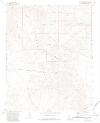
1970 Map of Bridge Canyon
USGS Topo · Published 1983About this map
The Newberry Mountains dominate this arid Clark County landscape, where water sources were the primary drivers of human presence. This 1970 survey records the intricate network of desert washes and canyons within the Lake Mead National Recreation Area, including the convergence of Pipe Springs Canyon and Dripping Springs Canyon. Significant evidence of early indigenous and historic travelers is preserved here, marked by Petroglyphs near Hiko Springs and at other points along Grapevine Canyon. The desert topography is further defined by seasonal water features like Sacatone Spring and Grapevine Wash. While much of the land remained untamed, late 20th-century infrastructure appears in the form of Radio Facilities, a Quarry, and a Substation, showing how modern utility and extraction began to touch the edges of these ancient mountain corridors.
Find a feature on this map
19 named features on this map. Tap any name to fly to it.
Don’t see what you’re looking for? This feature index may not catch every label — zoom into the map to look around manually.
Map Details
Editions of this 1970 Bridge Canyon Map
2 editions found
Other maps of this area

1886 · Camp Mohave
USGS Topo · 1:250,000

1892 · Camp Mohave
USGS Topo · 1:250,000

1926 · Mohave City
USGS Topo · 1:96,000

1942 · Camp Mohave
USGS Topo · 1:250,000

1947 · Kingman
USGS Topo · 1:250,000

1948 · Kingman
USGS Topo · 1:250,000

1950 · Davis Dam
USGS Topo · 1:62,500

1952 · Davis Dam
USGS Topo · 1:62,500

1954 · Kingman
USGS Topo · 1:250,000

1955 · Kingman
USGS Topo · 1:250,000