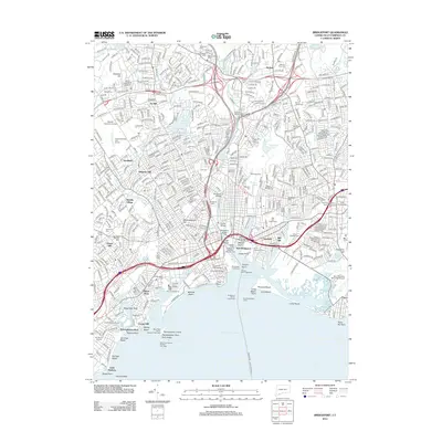
2012 Map of Bridgeport
USGS Topo · Published 2012About this map
Bridgeport Harbor serves as the focal point for this 2012 survey, illustrating the complex maritime and industrial landscape where the Pequonnock River and Yellow Mill Pond meet Long Island Sound. The map reveals a dense network of neighborhoods including Black Rock, Newfield, and Marina Village, alongside the expansive grounds of the University of Bridgeport and Sacred Heart University. Significant infrastructure like the East End Freight Yards and the Igor I Sikorsky Memorial Airport highlights the city's role as a transportation hub.
Find a feature on this map
117 named features on this map. Tap any name to fly to it.
Don’t see what you’re looking for? This feature index may not catch every label — zoom into the map to look around manually.
Map Details
Editions of this 2012 Bridgeport Map
This is the sole edition of this map. No revisions or reprints were ever made.
Other maps of this area

1889 · Derby
USGS Topo · 1:62,500

1891 · Bridgeport
USGS Topo · 1:62,500

1891 · Derby
USGS Topo · 1:62,500

1892 · Danbury
USGS Topo · 1:62,500

1892 · Norwalk
USGS Topo · 1:62,500

1893 · Bridgeport
USGS Topo · 1:62,500

1893 · Norwalk
USGS Topo · 1:62,500

1893 · Derby
USGS Topo · 1:62,500

1915 · Danbury
USGS Topo · 1:62,500

1920 · Bridgeport
USGS Topo · 1:62,500