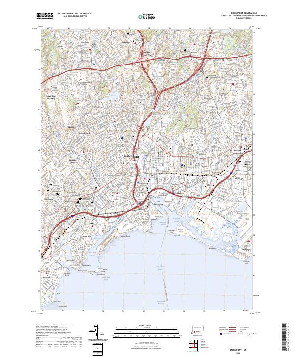
2024 Map of Bridgeport
USGS Topo · Published 2024About this map
The industrial and coastal layout of Bridgeport is defined by its complex shoreline, where the Pequonnock River meets Bridgeport Harbor and the Yellow Mill Channel. This modern topographical study illustrates a densely populated urban corridor transitioning into the suburban landscapes of Trumbull and Stratford. Along the coast, significant ecological and recreational spaces like Seaside Beach and the Stewart B McKinney National Wildlife Refuge at Great Meadows sit adjacent to vital transportation hubs such as the Bridgeport/Sikorsky Airport.
Find a feature on this map
108 named features on this map. Tap any name to fly to it.
Don’t see what you’re looking for? This feature index may not catch every label — zoom into the map to look around manually.
Map Details
Editions of this 2024 Bridgeport Map
This is the sole edition of this map. No revisions or reprints were ever made.
Other maps of this area

1889 · Derby
USGS Topo · 1:62,500

1891 · Bridgeport
USGS Topo · 1:62,500

1891 · Derby
USGS Topo · 1:62,500

1892 · Danbury
USGS Topo · 1:62,500

1892 · Norwalk
USGS Topo · 1:62,500

1893 · Bridgeport
USGS Topo · 1:62,500

1893 · Norwalk
USGS Topo · 1:62,500

1893 · Derby
USGS Topo · 1:62,500

1915 · Danbury
USGS Topo · 1:62,500

1920 · Bridgeport
USGS Topo · 1:62,500