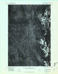
1975 Map of Bridgewater SW
USGS Topo · Published 1981About this map
The forest-dominated landscape of Aroostook County is shown here in detail through a 1975 aerial perspective. This orthophotograph centers on the winding course of the North Branch Meduxnekeag River and its tributary, South Brook. The imagery reveals the stark contrast between the dense woodlands and the geometric clearing patterns of the potato-farming region to the east.
Find a feature on this map
5 named features on this map. Tap any name to fly to it.
Don’t see what you’re looking for? This feature index may not catch every label — zoom into the map to look around manually.
Map Details
Editions of this 1975 Bridgewater SW Map
This is the sole edition of this map. No revisions or reprints were ever made.
Other maps of this area

1934 · Bridgewater
USGS Topo · 1:48,000

1935 · Howe Brook
USGS Topo · 1:48,000

1937 · Smyrna Mills
USGS Topo · 1:62,500

1938 · Bridgewater
USGS Topo · 1:62,500

1938 · Houlton
USGS Topo · 1:62,500

1939 · Howe Brook
USGS Topo · 1:62,500

1951 · Houlton
USGS Topo · 1:62,500

1951 · Bridgewater
USGS Topo · 1:62,500

1953 · Bridgewater
USGS Topo · 1:50,000

1954 · Howe Brook
USGS Topo · 1:62,500