
1934 Map of Bridgewater
USGS Topo · Published 1934About this map
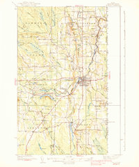
Bangor and Aroostook railroad tracks trace a vertical corridor through this 1934 survey of the Maine and New Brunswick borderlands, connecting the rural communities of Blaine, Bridgewater, and Monticello. The map documents a landscape defined by its position on the United States Canada Boundary Line, where US Customs stations are situated along the roads leading toward the international border. Away from the rail-centered settlements, the terrain is dotted with small-scale educational and religious landmarks such as the Flagstaff Sch and East Blaine Ch. Numerous family-named sites like Jewells Corner, Sharps Siding, and Harvey Siding indicate the importance of private enterprise and individual landholders in the local economy during the mid-1930s. The interior is characterized by complex hydrology including Whitehead Lake and the winding Meduxnekeag River, interspersed with topographic features like Bunker Hill and Estabrook Hill.
Find a feature on this map
74 named features on this map. Tap any name to fly to it.
Don’t see what you’re looking for? This feature index may not catch every label — zoom into the map to look around manually.
Map Details
Editions of this 1934 Bridgewater Map
This is the sole edition of this map. No revisions or reprints were ever made.
Other maps of this area

1935 · Howe Brook
USGS Topo · 1:48,000

1935 · Presque Isle
USGS Topo · 1:62,500

1936 · Mars Hill
USGS Topo · 1:48,000

1937 · Smyrna Mills
USGS Topo · 1:62,500

1938 · Bridgewater
USGS Topo · 1:62,500
1938 · Houlton
USGS Topo · 1:62,500

1939 · Howe Brook
USGS Topo · 1:62,500
1940 · Mars Hill
USGS Topo · 1:62,500
1951 · Mars Hill
USGS Topo · 1:62,500
1951 · Houlton
USGS Topo · 1:62,500