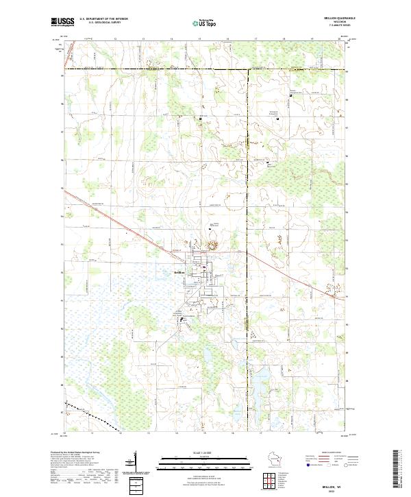
2022 Map of Brillion
USGS Topo · Published 2022About this map
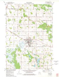
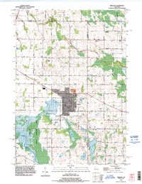
Brillion serves as the central hub for this portion of eastern Wisconsin, where the borders of Calumet, Brown, and Manitowoc counties converge. The landscape is characterized by a dense concentration of religious and community heritage sites, including Saint Mary's Cem, Brillion Community Cem - South, and Trinity Lutheran Cem - South. A series of glacial lakes and waterways, such as Grass Lake, Round Lake, and Long Lake, define the southern terrain, feeding into the North Branch Manitowoc River. The Friendship State Trl cuts across the center of the region, repurposing an old transportation corridor for modern recreation. This survey highlights the deep-rooted settlement patterns of the area, where rural crossroads are often marked by small burial grounds like Bluff Cem and Emmanuel Evangelical Cem, reflecting the early immigrant communities that established these townships.
Find a feature on this map
100 named features on this map. Tap any name to fly to it.
Don’t see what you’re looking for? This feature index may not catch every label — zoom into the map to look around manually.
Map Details
Editions of this 2022 Brillion Map
This is the sole edition of this map. No revisions or reprints were ever made.
Historical Maps of Brillion Through Time
3 maps found