
1974 Map of Brillion
USGS Topo · Published 1977About this map
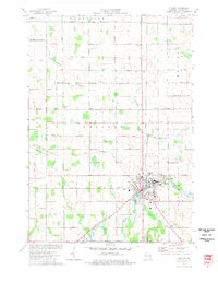
The city of Brillion serves as the industrial and social heart of this landscape at the intersection of the Chicago and North Western railroad and several county thoroughfares. The 1974 survey highlights a mid-century balance of agricultural land and manufacturing, evidenced by the Industrial Waste Pond near the city center and the numerous Gravel Pits scattered across the countryside. To the southwest, the Brillion State Wildlife Area preserves the marshy lowlands of Spring Creek and Black Creek, offering a stark contrast to the gridded farmsteads of Holland and Maple Grove.
Find a feature on this map
55 named features on this map. Tap any name to fly to it.
Don’t see what you’re looking for? This feature index may not catch every label — zoom into the map to look around manually.
Map Details
Editions of this 1974 Brillion Map
This is the sole edition of this map. No revisions or reprints were ever made.
Other maps of this area

1954 · De Pere
USGS Topo · 1:62,500

1954 · Denmark
USGS Topo · 1:62,500

1954 · Chilton
USGS Topo · 1:62,500

1954 · Reedsville
USGS Topo · 1:62,500

1954 · Manitowoc
USGS Topo · 1:250,000

1955 · Green Bay
USGS Topo · 1:250,000

1958 · Manitowoc
USGS Topo · 1:250,000

1974 · Hilbert
USGS Topo · 1:24,000
1974 · Chilton
USGS Topo · 1:24,000
1974 · Potter
USGS Topo · 1:24,000