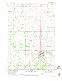
1974 Map of Chilton
USGS Topo · Published 1977About this map
The Manitowoc River and its South Branch define the landscape of Calumet County in the mid-1970s, converging at the city of Chilton. This area serves as a significant regional hub where the Chicago Milwaukee St Paul and Pacific and the Chicago and North Western railroads intersect. The map documents the city's infrastructure during this era, including the Fairground, the County Museum near a local Quarry, and the Hickory Hills Country Club to the north.
Find a feature on this map
44 named features on this map. Tap any name to fly to it.
Don’t see what you’re looking for? This feature index may not catch every label — zoom into the map to look around manually.
Map Details
Editions of this 1974 Chilton Map
This is the sole edition of this map. No revisions or reprints were ever made.
Other maps of this area

1910 · Fond du Lac
USGS Topo · 1:62,500

1911 · Neenah
USGS Topo · 1:62,500

1954 · Chilton
USGS Topo · 1:62,500

1954 · Kiel
USGS Topo · 1:62,500

1955 · Neenah
USGS Topo · 1:62,500

1955 · Fond Du Lac
USGS Topo · 1:62,500

1955 · Green Bay
USGS Topo · 1:250,000

1957 · Madison
USGS Topo · 1:250,000

1960 · Madison
USGS Topo · 1:250,000
1974 · Kiel
USGS Topo · 1:24,000