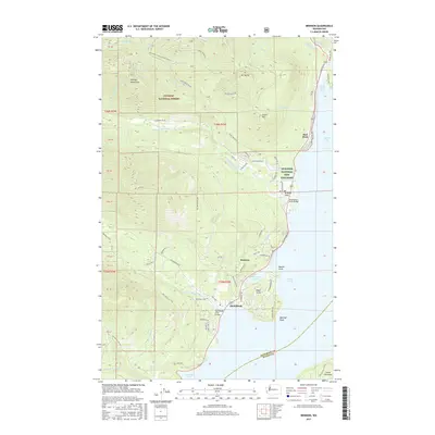
2017 Map of Brinnon
USGS Topo · Published 2017About this map
The community of Brinnon and the surrounding shoreline of Hood Canal define this coastal landscape on the edge of the Olympic Mountains. This 2017 survey shows the intricate intersection of maritime geography and managed wilderness, where the Dosewallips River and Duckabush River descend from high peaks like Mt Jupiter to meet the saltwater at Brinnon Flats. The map documents established infrastructure, including the Dosewallips River Bridge and Duckabush River Bridge, which serve as vital connectors for the corridor. Historical land use is evident in the presence of the Quilcene National Fish Hatchery and the expansive boundaries of the Olympic National Forest. From the sheltered waters of Pleasant Harbor to the prominent heights of Mt Turner, the area reflects a balance between timber management, local settlement, and the varied coastline of Dabob Bay.
Find a feature on this map
72 named features on this map. Tap any name to fly to it.
Don’t see what you’re looking for? This feature index may not catch every label — zoom into the map to look around manually.
Map Details
Editions of this 2017 Brinnon Map
This is the sole edition of this map. No revisions or reprints were ever made.
Other maps of this area

1936 · Point Misery
USGS Topo · 1:62,500

1938 · Mt Constance
USGS Topo · 1:125,000

1940 · Point Misery
USGS Topo · 1:62,500

1940 · Quilcene
USGS Topo · 1:62,500

1946 · Tyler Peak
USGS Topo · 1:62,500

1947 · The Brothers
USGS Topo · 1:62,500

1948 · Tyler Peak
USGS Topo · 1:62,500

1950 · The Brothers
USGS Topo · 1:62,500

1953 · Seabeck
USGS Topo · 1:24,000

1953 · Quilcene
USGS Topo · 1:24,000