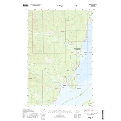
2020 Map of Brinnon
USGS Topo · Published 2020About this map
The western shore of the Hood Canal dominates this coastal landscape, where the Olympic foothills meet the saltwater of Dabob Bay. The settlement of Brinnon sits at the heart of the map, situated between the mouths of the Dosewallips River and the Duckabush River. This 2020 survey illustrates the contemporary road network following the rugged shoreline, including the established US Highway 101 and the winding Old Brinnon Highway.
Find a feature on this map
85 named features on this map. Tap any name to fly to it.
Don’t see what you’re looking for? This feature index may not catch every label — zoom into the map to look around manually.
Map Details
Editions of this 2020 Brinnon Map
This is the sole edition of this map. No revisions or reprints were ever made.
Other maps of this area

1936 · Point Misery
USGS Topo · 1:62,500

1938 · Mt Constance
USGS Topo · 1:125,000

1940 · Point Misery
USGS Topo · 1:62,500

1940 · Quilcene
USGS Topo · 1:62,500

1946 · Tyler Peak
USGS Topo · 1:62,500

1947 · The Brothers
USGS Topo · 1:62,500

1948 · Tyler Peak
USGS Topo · 1:62,500

1950 · The Brothers
USGS Topo · 1:62,500

1953 · Seabeck
USGS Topo · 1:24,000

1953 · Quilcene
USGS Topo · 1:24,000