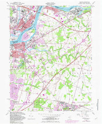
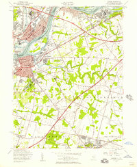
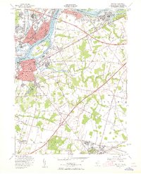
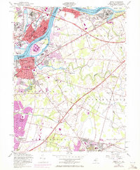
1955 Map of Bristol
USGS Topo · Published 1982About this map
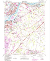
The Delaware River defines the geography of this mid-century industrial and residential corridor, separating Bristol, Pennsylvania, from Burlington, New Jersey. Large river features like Burlington Island and Newbold Island sit adjacent to bustling riverfront settlements including the company town of Roebling and the growing residential tracts of Margo Gardens and Winder Village. The map documents a landscape in transition as the New Jersey Turnpike and the Pennsylvania Turnpike Extension carve through established farmland, connecting the region's diverse communities.
Find a feature on this map
67 named features on this map. Tap any name to fly to it.
Don’t see what you’re looking for? This feature index may not catch every label — zoom into the map to look around manually.
Map Details
Editions of this 1955 Bristol Map
5 editions found
Other maps of this area

1888 · Bordentown
USGS Topo · 1:62,500

1888 · Pemberton
USGS Topo · 1:62,500

1888 · Mount Holly
USGS Topo · 1:62,500

1890 · Burlington
USGS Topo · 1:62,500

1893 · Bordentown
USGS Topo · 1:62,500

1893 · Burlington
USGS Topo · 1:62,500

1894 · Pemberton
USGS Topo · 1:62,500

1894 · Mount Holly
USGS Topo · 1:62,500

1898 · Pemberton
USGS Topo · 1:62,500

1898 · Mount Holly
USGS Topo · 1:62,500
Featured Places
- Falls Township, PA
- Willingboro Township, NJ
- Bordentown Township, NJ
- Florence Township, NJ
- Mount Holly Township, NJ