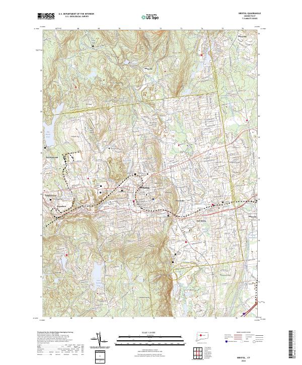
2024 Map of Bristol
USGS Topo · Published 2024About this map
Bristol serves as the central hub of this modern survey, flanked by the industrial and residential pockets of Forestville, Terryville, and Pequabuck. The landscape is a complex mix of urban density and elevated terrain, where heights like Federal Hill, South Mtn, and Chippen Hill overlook a network of waterways including the Pequabuck River and Whigville Brook. Genealogists will find a wealth of data in the numerous burial sites, from the Old North Burying Grounds and West Cem to the modern Saint Josephs Cem South.
Find a feature on this map
216 named features on this map. Tap any name to fly to it.
Don’t see what you’re looking for? This feature index may not catch every label — zoom into the map to look around manually.
Map Details
Editions of this 2024 Bristol Map
This is the sole edition of this map. No revisions or reprints were ever made.
Historical Maps of Allentown Through Time
4 maps found