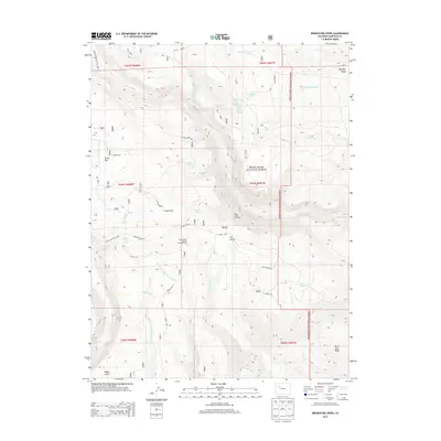
2013 Map of Broken Rib Creek
USGS Topo · Published 2013About this map
White River National Forest defines the high-country landscape of this Garfield County quadrangle, where a complex network of springs and drainages feed into larger systems. The map illustrates a high-elevation plateau marked by features such as W Deep Creek Rim and Monegar Ridge, which overlook the deep incisions of Deep Creek and French Creek. This area serves as a vital watershed, characterized by numerous named water sources including Ballsburg Spring, Irrawaddy Spring, and Sheep Spring.
Find a feature on this map
48 named features on this map. Tap any name to fly to it.
Don’t see what you’re looking for? This feature index may not catch every label — zoom into the map to look around manually.
Map Details
Editions of this 2013 Broken Rib Creek Map
This is the sole edition of this map. No revisions or reprints were ever made.
Other maps of this area

1927 · Glenwood Springs
USGS Topo · 1:125,000

1930 · Glenwood Springs
USGS Topo · 1:125,000

1957 · Leadville
USGS Topo · 1:250,000

1959 · Leadville
USGS Topo · 1:250,000

1960 · Leadville
USGS Topo · 1:250,000

1961 · Cottonwood Pass
USGS Topo · 1:24,000

1961 · Shoshone
USGS Topo · 1:24,000

1961 · Glenwood Springs
USGS Topo · 1:24,000

1962 · Leadville
USGS Topo · 1:250,000

1964 · Leadville
USGS Topo · 1:250,000