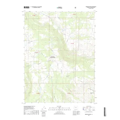
2019 Map of Broken Rib Creek
USGS Topo · Published 2019About this map
White River National Forest defines this high-elevation landscape in Garfield County, where a complex network of drainage basins and named springs suggests a vital watershed for the region. The terrain is characterized by prominent high points like Willow Peak and Windy Point, along with significant geologic features such as the West Deep Creek Rim. Water sources are densely mapped, including Short Creek Spring Number 1, Ballisburg Spring, and Maynes Spring, indicating their importance for local ecology and perhaps early livestock management. Moving south, the map details the descent into the Tie Gulch and Wagon Gulch areas. Access to these remote highlands is traced through forest routes like Coffee Pot Rd and several Bureau of Land Management tracks, including BLM Route 8441, which wind past landmarks such as Burnt Tree Ridge.
Find a feature on this map
52 named features on this map. Tap any name to fly to it.
Don’t see what you’re looking for? This feature index may not catch every label — zoom into the map to look around manually.
Map Details
Editions of this 2019 Broken Rib Creek Map
This is the sole edition of this map. No revisions or reprints were ever made.
Other maps of this area

1927 · Glenwood Springs
USGS Topo · 1:125,000

1930 · Glenwood Springs
USGS Topo · 1:125,000

1957 · Leadville
USGS Topo · 1:250,000

1959 · Leadville
USGS Topo · 1:250,000

1960 · Leadville
USGS Topo · 1:250,000

1961 · Cottonwood Pass
USGS Topo · 1:24,000

1961 · Shoshone
USGS Topo · 1:24,000

1961 · Glenwood Springs
USGS Topo · 1:24,000

1962 · Leadville
USGS Topo · 1:250,000

1964 · Leadville
USGS Topo · 1:250,000