
1921 Map of Bronte
USGS Topo · Published 1921About this map
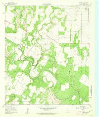
Bronte stands as the primary hub of this West Texas landscape during the early 1920s, showing a concentrated grid of streets positioned at the intersection of critical regional infrastructure. The Kansas City Mexico and Orient railroad cuts through the center of the sheet, dictating the development of the town and providing a vital link for the agricultural exports of Coke County. The surrounding terrain is heavily defined by the drainage systems of Kickapoo Creek and its many branches, including East Fork Kickapoo Creek and West Fork Kickapoo Creek. Rural life is anchored by localized landmarks such as Turkey Creek School and Union School, which served the scattered farmsteads. The presence of a small Cem near the town center and the winding path of Double Barrel Creek further illustrate the early settlement patterns and natural boundaries of this ranching and farming territory.
Find a feature on this map
10 named features on this map. Tap any name to fly to it.
Don’t see what you’re looking for? This feature index may not catch every label — zoom into the map to look around manually.
Map Details
Editions of this 1921 Bronte Map
This is the sole edition of this map. No revisions or reprints were ever made.
Other maps of this area

1891 · Hayrick
USGS Topo · 1:125,000

1893 · Sweetwater
USGS Topo · 1:125,000

1894 · Hayrick
USGS Topo · 1:125,000

1921 · Maverick
USGS Topo · 1:31,680

1921 · Mays School
USGS Topo · 1:31,680

1954 · Big Spring
USGS Topo · 1:250,000

1954 · San Angelo
USGS Topo · 1:250,000

1958 · San Angelo
USGS Topo · 1:250,000

1958 · Big Spring
USGS Topo · 1:250,000
1961 · Maverick
USGS Topo · 1:24,000