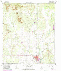
1961 Map of Bronte
USGS Topo · Published 1988About this map
The town of Bronte sits at the junction of State Highway 158 and U.S. Route 277, serving as a hub for the surrounding ranching and petroleum country during the early 1960s. The landscape is defined by the triple drainage of West Kickapoo Creek, Middle Kickapoo Creek, and East Kickapoo Creek, which carve through the Edwards Plateau terrain toward the southeast. The map reveals a clear intersection of frontier history and industrial development, with the Fort Chadbourne site and its associated Fort Chadbourne Cem located north of prominent topographic landmarks like Kickapoo Mountain and Nipple Peak.
Find a feature on this map
22 named features on this map. Tap any name to fly to it.
Don’t see what you’re looking for? This feature index may not catch every label — zoom into the map to look around manually.
Map Details
Editions of this 1961 Bronte Map
2 editions found
Other maps of this area

1891 · Hayrick
USGS Topo · 1:125,000

1893 · Sweetwater
USGS Topo · 1:125,000

1894 · Hayrick
USGS Topo · 1:125,000

1921 · Bronte
USGS Topo · 1:31,680

1921 · Maverick
USGS Topo · 1:31,680

1921 · Mays School
USGS Topo · 1:31,680

1954 · Big Spring
USGS Topo · 1:250,000

1954 · San Angelo
USGS Topo · 1:250,000

1958 · San Angelo
USGS Topo · 1:250,000

1958 · Big Spring
USGS Topo · 1:250,000