
1921 Map of Mays School
USGS Topo · Published 1921About this map
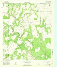
The Colorado River carves a deep, winding course through Coke County in this 1921 survey, where steep bluffs and complex drainage systems define the West Texas landscape. This map captures the local infrastructure before modern developments, highlighting the isolated Mays School as a central landmark for the surrounding rural community. The Kansas City Mexico and Orient railroad cuts a north-south path across the river, showing the intersection of industrial transport and the natural geography of the plains. Water sources like Kickapoo Creek and Barrel Creek branch off from the main river valley, revealing the importance of these seasonal or permanent flows in a region dominated by rugged draws and limestone plateaus. Surveyors C.C. Holder and C.W. Rowell meticulously recorded the varied elevation, from the floodplain up to the high ridges of the Pecos country.
Find a feature on this map
7 named features on this map. Tap any name to fly to it.
Don’t see what you’re looking for? This feature index may not catch every label — zoom into the map to look around manually.
Map Details
Editions of this 1921 Mays School Map
This is the sole edition of this map. No revisions or reprints were ever made.
Other maps of this area

1891 · Hayrick
USGS Topo · 1:125,000

1894 · Hayrick
USGS Topo · 1:125,000

1921 · Bronte
USGS Topo · 1:31,680

1921 · Baker Flat
USGS Topo · 1:31,680

1921 · Maverick
USGS Topo · 1:31,680

1954 · San Angelo
USGS Topo · 1:250,000

1957 · Miles
USGS Topo · 1:62,500

1957 · Harriet
USGS Topo · 1:62,500

1958 · San Angelo
USGS Topo · 1:250,000
1961 · Maverick
USGS Topo · 1:24,000