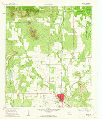
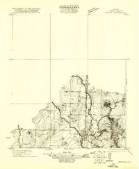
1961 Map of Bronte
USGS Topo · Published 1962About this map
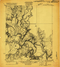
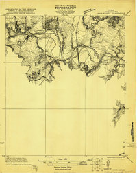
Bronte serves as the primary hub in this West Texas survey, situated at the junction of Highway 277 and Highway 158. The local economy in the early 1960s is clearly defined by the Bronte Oil Field and the Fort Chadbourne Oil Field, alongside the vital Panhandle and Santa Fe railroad corridor. The landscape is marked by prominent geological features such as Kickapoo Mountain and the distinctive Nipple Peak, while drainage follows the various branches of Kickapoo Creek. To the north, the settlement of Fort Chadbourne stands near the Fort Chadbourne Cemetery, providing a focal point for genealogical research. The map also captures smaller locales like Rawlings and topographical landmarks including Panther Gap and Jones Peak, offering a detailed look at the rural infrastructure of Coke County during this period of petroleum-driven development.
Find a feature on this map
20 named features on this map. Tap any name to fly to it.
Don’t see what you’re looking for? This feature index may not catch every label — zoom into the map to look around manually.
Map Details
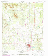
Editions of this 1961 Bronte Map
2 editions found
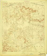
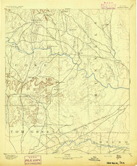
Other maps of this area

1891 · Hayrick
USGS Topo · 1:125,000
1893 · Sweetwater
USGS Topo · 1:125,000
1894 · Hayrick
USGS Topo · 1:125,000
1921 · Bronte
USGS Topo · 1:31,680
1921 · Maverick
USGS Topo · 1:31,680
1921 · Mays School
USGS Topo · 1:31,680

1954 · Big Spring
USGS Topo · 1:250,000

1954 · San Angelo
USGS Topo · 1:250,000

1958 · San Angelo
USGS Topo · 1:250,000

1958 · Big Spring
USGS Topo · 1:250,000