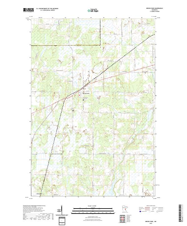
2022 Map of Brook Park
USGS Topo · Published 2022About this map
Brook Park and the smaller community of Henriette serve as the primary nodes of settlement in this Pine County landscape, where the drainage of Pokegama Creek and its various branches, including East Pokegama Creek, defines the low-lying terrain. The map captures a largely rural, grid-based road system that transitions across the boundary between Kanabec and Pine counties. Local history is anchored by sites like the Old Lutheran Church Cemetery and the Brook Park Cemetery, which provide vital touchstones for genealogical research in this part of Minnesota. The topography is notably influenced by the winding path of Pokegama Creek, which meanders through several sections, creating a complex network of wetlands and small tributaries that likely dictated the placement of early homesteads and secondary roads such as Beaver Claw Road and Sunny Hill Road.
Find a feature on this map
63 named features on this map. Tap any name to fly to it.
Don’t see what you’re looking for? This feature index may not catch every label — zoom into the map to look around manually.
Map Details
Editions of this 2022 Brook Park Map
This is the sole edition of this map. No revisions or reprints were ever made.
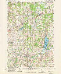
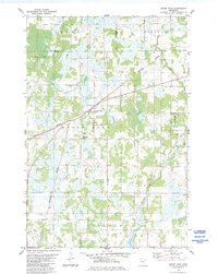
Historical Maps of Brook Park Township Through Time
3 maps found