Loading...
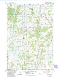
Loading map...1983 Map of Brook Park
USGS Topo · Published 1984About this map
The boundary between Kanabec Co Pine Co runs through a landscape of wetlands and low-lying drainages in the early 1980s. The settlement of Brook Park serves as the central hub of this quadrangle, situated along the Burlington Northern railroad line. This rail corridor follows a diagonal path through the township, which was historically significant for the regional timber and transport economy.
Find a feature on this map
14 named features on this map. Tap any name to fly to it.
Don’t see what you’re looking for? This feature index may not catch every label — zoom into the map to look around manually.
Map Details
Date Portrayed1983
Date Published1984
PublisherU.S. Geological Survey
Map TypeTopographic
Scale1:24000
Physical Dimensions21.53 x 27.23 inches
Editions of this 1983 Brook Park Map
This is the sole edition of this map. No revisions or reprints were ever made.
Historical Maps of Brook Park Through Time
3 maps found
Featured Locations
Source Details
SourceU.S. Geological Survey
CopyrightPublic Domain