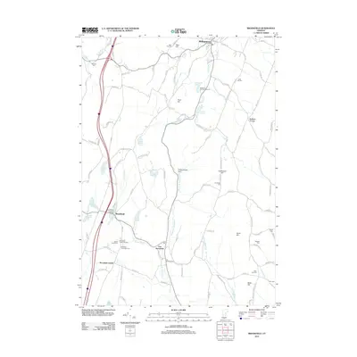
2012 Map of Brookfield
USGS Topo · Published 2012About this map
Brookfield Floating Bridge spans the waters of Sunset Lake, anchoring a cluster of historic villages and family-named hills in this central Vermont landscape. The settlement pattern remains concentrated around Brookfield, East Brookfield, and Brookfield Center, with many farm-to-market roads like Chelsea Rd and Robinson Rd connecting the upland ridges. Genealogy researchers will find numerous small burial grounds, including the Brookfield Center Old Cem and Wiggins Cem, often tucked away near stream branches like Sunset Brook.
Find a feature on this map
102 named features on this map. Tap any name to fly to it.
Don’t see what you’re looking for? This feature index may not catch every label — zoom into the map to look around manually.
Map Details
Editions of this 2012 Brookfield Map
This is the sole edition of this map. No revisions or reprints were ever made.
Other maps of this area

1896 · Strafford
USGS Topo · 1:62,500

1919 · Royalton
USGS Topo · 1:62,500

1922 · Barre
USGS Topo · 1:48,000

1924 · Barre
USGS Topo · 1:62,500

1924 · Randolph
USGS Topo · 1:48,000

1926 · Randolph
USGS Topo · 1:62,500

1944 · Strafford
USGS Topo · 1:62,500

1947 · Corinth
USGS Topo · 1:62,500

1948 · East Barre
USGS Topo · 1:62,500

1950 · Glens Falls
USGS Topo · 1:250,000