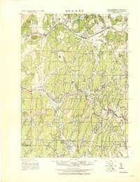
1943 Map of Brookfield
USGS Topo · Published 1943About this map
The Boston and Albany RR corridor defines the industrial and transportation spine of this region during the early 1940s, connecting manufacturing hubs like Warren and West Brookfield. The landscape is a transition from these busy rail towns to the intricate water systems of the southern hills, where the Hamilton Reservoir and Mashapaug Pond sit near the Massachusetts Connecticut Boundary Line. In Southbridge, the map captures a dense urban footprint at a time when local industry was deeply integrated with the Quaboag River watershed.
Find a feature on this map
87 named features on this map. Tap any name to fly to it.
Don’t see what you’re looking for? This feature index may not catch every label — zoom into the map to look around manually.
Map Details
Editions of this 1943 Brookfield Map
This is the sole edition of this map. No revisions or reprints were ever made.
Other maps of this area

1885 · Worcester
USGS Topo · 1:62,500

1886 · Worcester
USGS Topo · 1:62,500

1887 · Brookfield
USGS Topo · 1:62,500

1887 · Palmer
USGS Topo · 1:62,500

1887 · Belchertown
USGS Topo · 1:62,500

1887 · Barre
USGS Topo · 1:62,500

1889 · Webster
USGS Topo · 1:62,500

1889 · Putnam
USGS Topo · 1:62,500

1889 · Palmer
USGS Topo · 1:62,500

1889 · Barre
USGS Topo · 1:62,500