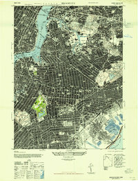
1947 Map of Brooklyn
USGS Topo · Published 1947About this map
Ebbets Field stands as a focal point in this 1940s urban survey, capturing the borough at a peak of industrial and residential density. The landscape is defined by its massive infrastructure, from the Navy Yard on Wallabout Bay to the intricate network of the New Lots Classification Yards and the Penn Tunnels. Extensive cemeteries such as Calvary Cemetery, Mount Zion Cemetery, and Holy Cross Cemetery create large green islands within the gridded streets of Ridgewood, Maspeth, and Canarsie.
Find a feature on this map
75 named features on this map. Tap any name to fly to it.
Don’t see what you’re looking for? This feature index may not catch every label — zoom into the map to look around manually.
Map Details
Editions of this 1947 Brooklyn Map
This is the sole edition of this map. No revisions or reprints were ever made.
Other maps of this area

1888 · Paterson
USGS Topo · 1:62,500

1889 · Brooklyn
USGS Topo · 1:62,500

1891 · Brooklyn
USGS Topo · 1:62,500

1891 · Harlem
USGS Topo · 1:62,500

1892 · Paterson
USGS Topo · 1:62,500

1897 · Harlem
USGS Topo · 1:62,500

1897 · Brooklyn
USGS Topo · 1:62,500

1898 · Harlem
USGS Topo · 1:62,500

1898 · Staten Island
USGS Topo · 1:62,500

1898 · Brooklyn
USGS Topo · 1:62,500