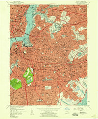
1956 Map of Brooklyn
USGS Topo · Published 1958About this map
The dense urban grid of Brooklyn and western Queens is captured in detail during the mid-1950s, a period of massive post-war infrastructure. The map illustrates the complex transit network crossing the East River, from the classic Brooklyn Bridge to the subterranean Pennsylvania Tunnel and Terminal RR. Massive industrial and institutional footprints dominate the waterfront, notably the U S Naval Reservation New York Shipyard at Wallabout Bay.
Find a feature on this map
116 named features on this map. Tap any name to fly to it.
Don’t see what you’re looking for? This feature index may not catch every label — zoom into the map to look around manually.
Map Details
Editions of this 1956 Brooklyn Map
2 editions found
Other maps of this area

1888 · Paterson
USGS Topo · 1:62,500

1889 · Brooklyn
USGS Topo · 1:62,500

1891 · Brooklyn
USGS Topo · 1:62,500

1891 · Harlem
USGS Topo · 1:62,500

1892 · Paterson
USGS Topo · 1:62,500

1897 · Harlem
USGS Topo · 1:62,500

1897 · Brooklyn
USGS Topo · 1:62,500

1898 · Harlem
USGS Topo · 1:62,500

1898 · Staten Island
USGS Topo · 1:62,500

1898 · Brooklyn
USGS Topo · 1:62,500