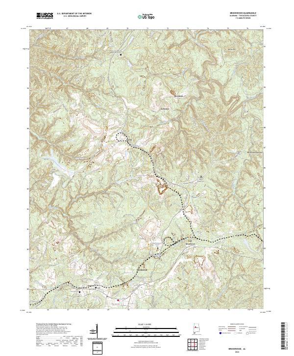
2024 Map of Brookwood
USGS Topo · Published 2024About this map
Brookwood and its surrounding hill country in Tuscaloosa County are defined by a complex network of industrial activity and established rural settlements. This modern survey illustrates the proximity of residential areas like East Brookwood and Howton to significant landmarks such as the Covol Nos Plant, reflecting the region's long-standing connection to local resources. The landscape is deeply carved by watercourses including Daniel Creek, Davis Creek, and Hanna Mill Creek, which wind through the terrain near the heights of Round Mtn and Martha Washington Mtn. For genealogists, the map is particularly useful for locating several distinct burial sites and congregations, including the Antioch Missionary Baptist Church Cem, Friendship Baptist Church Cem, and the Little Hurricane Cem. The presence of numerous specialized roads, such as Howell Camp Rd and Lock 17 Rd, further emphasizes the specialized industrial and transit patterns of this part of Alabama.
Find a feature on this map
76 named features on this map. Tap any name to fly to it.
Don’t see what you’re looking for? This feature index may not catch every label — zoom into the map to look around manually.
Map Details
Editions of this 2024 Brookwood Map
This is the sole edition of this map. No revisions or reprints were ever made.
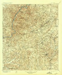
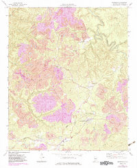
Historical Maps of Kellerman Through Time
3 maps found