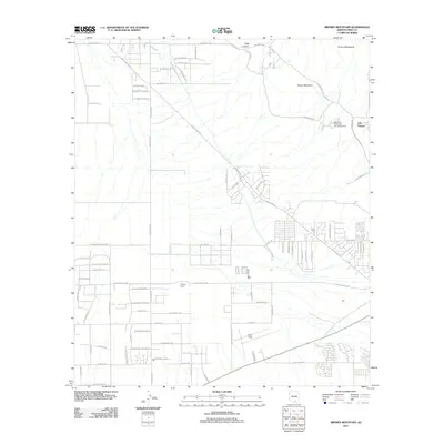
2011 Map of Brown Mountain
USGS Topo · Published 2011About this map
Brown Mountain and the surrounding Tucson Mountains define the high ground of this Arizona desert landscape, where suburban expansion meets preserved natural spaces and historic landmarks. The map documents the area during a period of residential growth, evidenced by the dense network of roads such as W Mile Wide Rd and N San Joaquin Rd. Cultural and recreational sites are well-represented, including the storied Old Tucson movie set and the Palo Verde Picnic Area and Campground. Farther south, the aviation legacy of the region is anchored by Ryan Field, while smaller historical holdings like Phillips Ranch remain part of the local geography. The desert terrain is dissected by numerous washes and canyons, most notably King Canyon, which cuts through the foothills near the western edges of the mountain range.
Find a feature on this map
78 named features on this map. Tap any name to fly to it.
Don’t see what you’re looking for? This feature index may not catch every label — zoom into the map to look around manually.
Map Details
Editions of this 2011 Brown Mountain Map
This is the sole edition of this map. No revisions or reprints were ever made.
Other maps of this area

1925 · San Xavier
USGS Topo · 1:62,500

1934 · Tucson Mountains
USGS Topo · 1:125,000

1941 · Cocoraque Butte
USGS Topo · 1:62,500

1943 · Cocoraque Butte
USGS Topo · 1:62,500

1943 · San Xavier Mission
USGS Topo · 1:62,500

1947 · Cortaro
USGS Topo · 1:62,500

1956 · Tucson
USGS Topo · 1:250,000

1957 · San Xavier Mission
USGS Topo · 1:62,500

1957 · Cortaro
USGS Topo · 1:62,500

1958 · Tucson
USGS Topo · 1:250,000