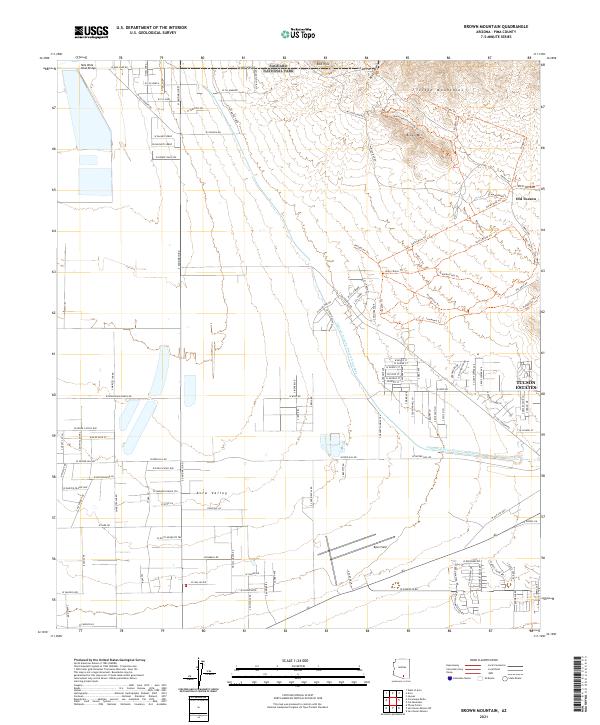
2021 Map of Brown Mountain
USGS Topo · Published 2021About this map
Saguaro National Park dominates the northern landscape of this region, where the Tucson Mountains rise above the desert floor. The map highlights a transition from the preserved wilderness of the Red Hills and Brown Mtn to the developing residential corridors of Tucson Estates. A significant modern engineering feature, the Central Arizona Project Aqueduct, cuts across the center of the sheet, illustrating the critical infrastructure required for water management in the arid southwest. To the east, Old Tucson stands as a notable landmark near the base of the mountains, while the southern reach includes Ryan Field and the community of Avra Valley. The extensive trail network, including the Brown Mountain Loop Trl and Gates Pass Trl, reflects the area's significance for recreation and access to the desert environment.
Find a feature on this map
127 named features on this map. Tap any name to fly to it.
Don’t see what you’re looking for? This feature index may not catch every label — zoom into the map to look around manually.
Map Details
Editions of this 2021 Brown Mountain Map
This is the sole edition of this map. No revisions or reprints were ever made.
Other maps of this area

1925 · San Xavier
USGS Topo · 1:62,500

1934 · Tucson Mountains
USGS Topo · 1:125,000

1941 · Cocoraque Butte
USGS Topo · 1:62,500

1943 · Cocoraque Butte
USGS Topo · 1:62,500

1943 · San Xavier Mission
USGS Topo · 1:62,500

1947 · Cortaro
USGS Topo · 1:62,500

1956 · Tucson
USGS Topo · 1:250,000

1957 · San Xavier Mission
USGS Topo · 1:62,500

1957 · Cortaro
USGS Topo · 1:62,500

1958 · Tucson
USGS Topo · 1:250,000