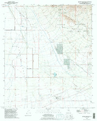
1992 Map of Brown Mountain
USGS Topo · Published 1995About this map
Tohono O'odham Nation lands define the western edge of this landscape, transitioning into the broad, arid expanse of the Avra Valley. The terrain rises sharply to the east into the Tucson Mountains, where Tucson Mountain Park and Saguaro National Park protect the desert environment. A notable cultural landmark is Old Tucson (Replica of 1870), a film set and theme park that reflects the region's historical identity through its period-accurate architecture.
Find a feature on this map
28 named features on this map. Tap any name to fly to it.
Don’t see what you’re looking for? This feature index may not catch every label — zoom into the map to look around manually.
Map Details
Editions of this 1992 Brown Mountain Map
This is the sole edition of this map. No revisions or reprints were ever made.
Other maps of this area

1925 · San Xavier
USGS Topo · 1:62,500

1934 · Tucson Mountains
USGS Topo · 1:125,000

1941 · Cocoraque Butte
USGS Topo · 1:62,500

1943 · Cocoraque Butte
USGS Topo · 1:62,500

1943 · San Xavier Mission
USGS Topo · 1:62,500

1947 · Cortaro
USGS Topo · 1:62,500

1956 · Tucson
USGS Topo · 1:250,000

1957 · San Xavier Mission
USGS Topo · 1:62,500

1957 · Cortaro
USGS Topo · 1:62,500

1958 · Tucson
USGS Topo · 1:250,000