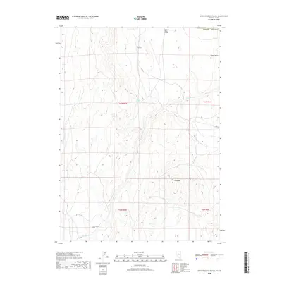
2018 Map of Browns Bench Ranch
USGS Topo · Published 2018About this map
Browns Bench Ranch sits at the high northern edge of this high-desert landscape where the Salmon River Range meets the vast plateau of Browns Bench. This 2018 survey reveals a terrain defined by its water sources, with vital points like Upper Maggie Spring and Burnt Creek Spring providing life in a region where the drainage of Cottonwood Cr carves through the topography. The map illustrates a working rangeland crossed by Oneil Rd and various Blm Rd tracks, connecting the ranch to high points such as Grassy Mtn. At the southern end of the sheet, the presence of Cottonwood Field suggests a focus of agricultural or pastoral activity near the creek bed. This map captures the modern layout of these remote Idaho and Nevada borderlands, showing the persistent relationship between isolated ranching outposts and the sparse natural springs of the Great Basin.
Find a feature on this map
15 named features on this map. Tap any name to fly to it.
Don’t see what you’re looking for? This feature index may not catch every label — zoom into the map to look around manually.
Map Details
Editions of this 2018 Browns Bench Ranch Map
This is the sole edition of this map. No revisions or reprints were ever made.
Other maps of this area

1955 · Twin Falls
USGS Topo · 1:250,000

1955 · Wells
USGS Topo · 1:250,000

1957 · Contact
USGS Topo · 1:62,500

1957 · Delaplain
USGS Topo · 1:62,500

1958 · Wells
USGS Topo · 1:250,000

1958 · Twin Falls
USGS Topo · 1:250,000

1961 · Wells
USGS Topo · 1:250,000

1977 · Browns Bench South
USGS Topo · 1:24,000

1978 · Taylor Canyon
USGS Topo · 1:24,000
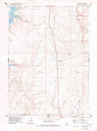
1978 · Meteor
USGS Topo · 1:24,000