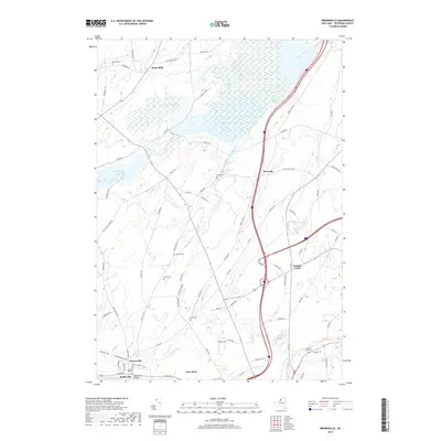
2019 Map of Brownville
USGS Topo · Published 2019About this map
The Black River defines the southern boundary of this Jefferson County landscape, anchoring the settlements of Brownville and Glen Park. Just across the Black River Bridge, the terrain rises toward the north where a network of small creeks like Philomel Cr and Parrish Cr carve through the countryside. This map captures a series of long-standing rural hamlets and junctions, including Stone Mills, Noseville, and Pamelia Center. For genealogists, the density of family-named burial grounds is striking, with sites such as Rouses Cem, Stevens Cem, and Pettit Cem scattered along the local road system. The northern reach is dominated by the wetlands surrounding Perch Lake and the Perch River, illustrating the persistent hydrography of the region even as modern highway infrastructure intersects the older rural layout.
Find a feature on this map
83 named features on this map. Tap any name to fly to it.
Don’t see what you’re looking for? This feature index may not catch every label — zoom into the map to look around manually.
Map Details
Editions of this 2019 Brownville Map
This is the sole edition of this map. No revisions or reprints were ever made.
Other maps of this area

1893 · Sackets Harbor
USGS Topo · 1:62,500

1895 · Sacketts Harbor
USGS Topo · 1:62,500

1895 · Watertown
USGS Topo · 1:62,500

1898 · Watertown
USGS Topo · 1:62,500

1900 · Clayton
USGS Topo · 1:62,500

1903 · Clayton
USGS Topo · 1:62,500

1903 · Theresa
USGS Topo · 1:62,500

1908 · Watertown
USGS Topo · 1:62,500

1909 · Watertown
USGS Topo · 1:62,500

1942 · Clayton
USGS Topo · 1:24,000