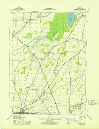
1943 Map of Brownville
USGS Topo · Published 1943About this map
Stone Mills and Gunn Corners anchor the rural landscape of Jefferson County during the early 1940s, a period when the region was defined by a dense network of one-room schoolhouses and family burial grounds. The agricultural character of Pamelia and the surrounding townships is evident in the numerous numbered school districts, ranging from School No 1 to School No 10, scattered along the local road system. The Perch River flows through the center of the quadrangle, feeding into a marshy expanse below Perch Lake, creating a distinct natural corridor that constrained early settlement patterns. To the south, the industrial and transport hub of Brownville and Glen Park sits along the New York Central railroad, where Philomel Creek joins the larger river system. Genealogists will find significant value in the documentation of smaller family and community plots such as Stevens Cem and Pettit Cem.
Find a feature on this map
35 named features on this map. Tap any name to fly to it.
Don’t see what you’re looking for? This feature index may not catch every label — zoom into the map to look around manually.
Map Details
Editions of this 1943 Brownville Map
This is the sole edition of this map. No revisions or reprints were ever made.
Other maps of this area

1893 · Sackets Harbor
USGS Topo · 1:62,500

1895 · Sacketts Harbor
USGS Topo · 1:62,500

1895 · Watertown
USGS Topo · 1:62,500

1898 · Watertown
USGS Topo · 1:62,500

1900 · Clayton
USGS Topo · 1:62,500

1903 · Clayton
USGS Topo · 1:62,500

1903 · Theresa
USGS Topo · 1:62,500

1908 · Watertown
USGS Topo · 1:62,500

1909 · Watertown
USGS Topo · 1:62,500

1942 · Clayton
USGS Topo · 1:24,000