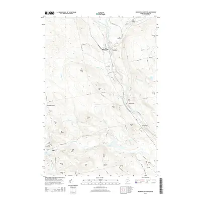
2014 Map of Brownville Junction
USGS Topo · Published 2014About this map
Brownville Junction and Brownville sit at the confluence of the West Branch Pleasant River and East Branch Pleasant River, forming a central hub in the Maine woods. This 2014 survey captures the region's complex water network, including the Sebec River flowing out of Sebec Lake and the various brooks that drain the surrounding highlands like Merrill Hill and Gerrish Hill. The landscape is dotted with small settlements such as Barnard Corner and Sebec, along with numerous local cemeteries like Town Farm Hill Cem and Cowan Extension Cem that serve as vital links for genealogists tracing Piscataquis County families. Aviation history is represented by the Webber Jones Airport, while the terrain remains defined by prominent landmarks such as Mt Misery and the agricultural legacy evident at Town Farm Hill.
Find a feature on this map
88 named features on this map. Tap any name to fly to it.
Don’t see what you’re looking for? This feature index may not catch every label — zoom into the map to look around manually.
Map Details
Editions of this 2014 Brownville Junction Map
This is the sole edition of this map. No revisions or reprints were ever made.
Other maps of this area

1932 · Dover-Foxcroft
USGS Topo · 1:48,000

1933 · Boyd Lake
USGS Topo · 1:62,500

1935 · Dover-Foxcroft
USGS Topo · 1:62,500

1940 · Sebec
USGS Topo · 1:48,000

1943 · Sebec
USGS Topo · 1:62,500

1947 · Schoodic
USGS Topo · 1:62,500

1949 · Schoodic
USGS Topo · 1:62,500

1951 · Boyd Lake
USGS Topo · 1:50,000

1954 · Millinocket
USGS Topo · 1:250,000

1955 · Boyd Lake
USGS Topo · 1:62,500