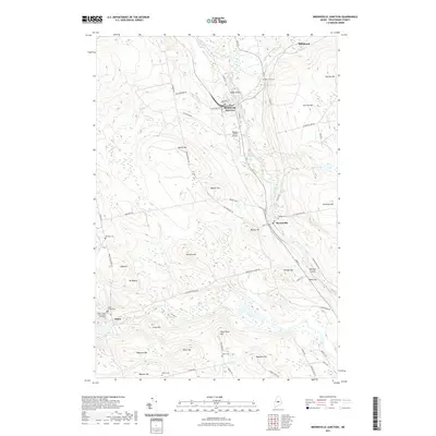
2021 Map of Brownville Junction
USGS Topo · Published 2021About this map
Brownville Junction serves as the focal point of this Piscataquis County landscape, where the Pleasant River flows past the settlement and around Herrick Island. The map reveals a community defined by its geography and civic infrastructure, from the Webber Jones Airport on the riverbank to the numerous hills that ring the valley. The rural character of the region is evident in the distribution of family-named heights and local burial grounds, including the Barnard Cem and Pine Tree Cem. To the southwest, the village of Sebec sits near the Sebec Village Cem, marking an area with deep genealogical roots. The terrain is notably varied, featuring prominent summits like Mt Misery and Town Farm Hill, while smaller water bodies like Tannery Pond suggest the historic industrial uses of the local waterways.
Find a feature on this map
64 named features on this map. Tap any name to fly to it.
Don’t see what you’re looking for? This feature index may not catch every label — zoom into the map to look around manually.
Map Details
Editions of this 2021 Brownville Junction Map
This is the sole edition of this map. No revisions or reprints were ever made.
Other maps of this area

1932 · Dover-Foxcroft
USGS Topo · 1:48,000

1933 · Boyd Lake
USGS Topo · 1:62,500

1935 · Dover-Foxcroft
USGS Topo · 1:62,500

1940 · Sebec
USGS Topo · 1:48,000

1943 · Sebec
USGS Topo · 1:62,500

1947 · Schoodic
USGS Topo · 1:62,500

1949 · Schoodic
USGS Topo · 1:62,500

1951 · Boyd Lake
USGS Topo · 1:50,000

1954 · Millinocket
USGS Topo · 1:250,000

1955 · Boyd Lake
USGS Topo · 1:62,500