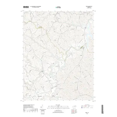
2019 Map of Bruin
USGS Topo · Published 2019About this map
Newfoundland and Ibex anchor this survey of the northern Kentucky hills, where the landscape is defined by the branching waters of Big Gimlet Creek and the Little Caney Cr. The map shows a region shaped by its geology and early family settlements, evidenced by numerous burial sites like Kegley Cem and Oney Cem that populate the ridge-and-hollow terrain. The transition from high ground to water is marked by distinctive natural features such as Lick Falls and the Chalybeate Spring.
Find a feature on this map
120 named features on this map. Tap any name to fly to it.
Don’t see what you’re looking for? This feature index may not catch every label — zoom into the map to look around manually.
Map Details
Editions of this 2019 Bruin Map
This is the sole edition of this map. No revisions or reprints were ever made.
Other maps of this area

1903 · Kenova
USGS Topo · 1:125,000

1904 · Kenova
USGS Topo · 1:125,000

1950 · Bruin
USGS Topo · 1:24,000

1950 · Grahn
USGS Topo · 1:24,000

1950 · Isonville
USGS Topo · 1:24,000

1950 · Olive Hill
USGS Topo · 1:24,000

1950 · Ault
USGS Topo · 1:24,000

1950 · Sandy Hook
USGS Topo · 1:24,000

1953 · Grayson
USGS Topo · 1:24,000
1953 · Mazie
USGS Topo · 1:24,000