
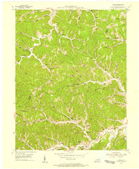
1950 Map of Bruin
USGS Topo · Published 1952About this map
Little Sandy River and its winding tributaries dominate this 1950 topographical study of the border between Carter and Elliott counties. The landscape is characterized by a dense network of hollows and ridges, with settlements like Newfoundland and Bruin serving as local hubs. The region's early industrial activity is evidenced by Clay Mines located near the northern edge of the map, while numerous small rural schools like Ibex Waddell Sch and Cliffside Sch suggest a decentralized but active community structure.
Find a feature on this map
68 named features on this map. Tap any name to fly to it.
Don’t see what you’re looking for? This feature index may not catch every label — zoom into the map to look around manually.
Map Details
Editions of this 1950 Bruin Map
This is the sole edition of this map. No revisions or reprints were ever made.
Other maps of this area

1903 · Kenova
USGS Topo · 1:125,000

1904 · Kenova
USGS Topo · 1:125,000

1950 · Grahn
USGS Topo · 1:24,000

1950 · Isonville
USGS Topo · 1:24,000

1950 · Olive Hill
USGS Topo · 1:24,000

1950 · Ault
USGS Topo · 1:24,000

1950 · Sandy Hook
USGS Topo · 1:24,000

1953 · Grayson
USGS Topo · 1:24,000
1953 · Mazie
USGS Topo · 1:24,000
1953 · Willard
USGS Topo · 1:24,000