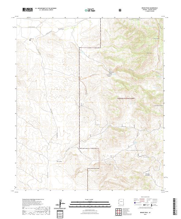
2021 Map of Bruno Peak
USGS Topo · Published 2021About this map
Bruno Peak stands as a central landmark in this high-altitude corner of the Chiricahua Mountains, where the landscape transitions into the Pedregosa Mountains to the south. The topography is defined by a complex network of drainages and passes, including Rucker Canyon and the winding Bruno Canyon. This territory is primarily managed by the Coronado National Forest, with a significant portion dedicated to the Leslie Canyon National Wildlife Refuge in the southwest quadrant. Human history in this remote section of Cochise County is marked by the presence of the Rucker Cem and ranching infrastructure. Numerous water sources, such as Winkler Tank and Glenn Tank, are scattered across the terrain, connected by primitive routes like the Bruno Pipeline Trl and the N Bar Boot Ranch Rd. The map illustrates the specialized water-management needs of this arid environment, showing how natural draws like Mesa Draw and High Lonesome Canyon dictate the placement of livestock tanks and trails.
Find a feature on this map
37 named features on this map. Tap any name to fly to it.
Don’t see what you’re looking for? This feature index may not catch every label — zoom into the map to look around manually.
Map Details
Editions of this 2021 Bruno Peak Map
This is the sole edition of this map. No revisions or reprints were ever made.
Other maps of this area

1916 · Pearce
USGS Topo · 1:125,000

1917 · Chiricahua
USGS Topo · 1:125,000

1919 · Chiricahua
USGS Topo · 1:125,000

1922 · Swisshelm
USGS Topo · 1:62,500

1926 · Light
USGS Topo · 1:62,500

1926 · Rucker
USGS Topo · 1:62,500

1926 · Pedregosa
USGS Topo · 1:62,500

1955 · Douglas
USGS Topo · 1:250,000

1958 · Chiricahua Peak
USGS Topo · 1:62,500

1958 · Squaretop Hills
USGS Topo · 1:62,500