
1958 Map of Chiricahua Peak
USGS Topo · Published 1958About this map
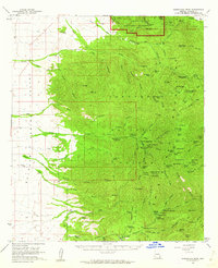
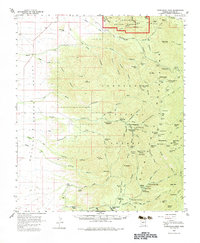
Chiricahua Mountains dominate the landscape in this mid-century survey, rising sharply above the Sulphur Spring Valley to the west. The map documents a rugged wilderness managed by the Chiricahua National Forest, including the distinct rock formations within the Chiricahua National Monument. Mining activity is recorded at the Hilltop Mine and El Tigre Mine, while the higher elevations are dotted with remote outposts like the Turkey Cr Ranger Sta and Cima Ranger Sta. Numerous canyons, such as Jesse James Canyon and Sarah Deming Canyon, cut through the range, providing drainage for a network of creeks including Turkey Creek and Rucker Creek. Local habitation is sparse, centered on sites like Riggs and family holdings such as Dart Ranch and Winkler Ranch. Recreational use is evident through various forest camps and the Methodist Camp near Dewings Pass.
Find a feature on this map
102 named features on this map. Tap any name to fly to it.
Don’t see what you’re looking for? This feature index may not catch every label — zoom into the map to look around manually.
Map Details
Editions of this 1958 Chiricahua Peak Map
3 editions found
Other maps of this area

1916 · Pearce
USGS Topo · 1:125,000

1917 · San Simon
USGS Topo · 1:125,000

1917 · Chiricahua
USGS Topo · 1:125,000

1919 · Chiricahua
USGS Topo · 1:125,000

1922 · Willcox
USGS Topo · 1:125,000

1922 · Swisshelm
USGS Topo · 1:62,500

1926 · Light
USGS Topo · 1:62,500

1926 · Cochise Head
USGS Topo · 1:62,500

1926 · Rodeo
USGS Topo · 1:62,500

1926 · Rucker
USGS Topo · 1:62,500