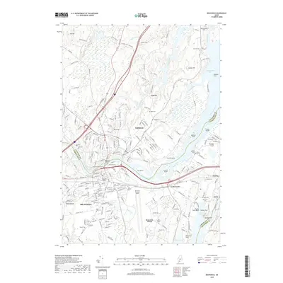
2018 Map of Brunswick
USGS Topo · Published 2018About this map
Bowdoin College and the surrounding urban grid of Brunswick anchor the southern portion of this landscape, where the Androscoggin River separates the town from Topsham. The river's path is marked by numerous islands including Cow Island and Mustard Island, eventually widening into the tidal expanse of Merrymeeting Bay. This 2018 survey reveals a high density of commemorative sites, from the Ancient Burying Ground near the river to the remote Heuston Burying Ground and the Annie Simpson Grave farther east.
Find a feature on this map
191 named features on this map. Tap any name to fly to it.
Don’t see what you’re looking for? This feature index may not catch every label — zoom into the map to look around manually.
Map Details
Editions of this 2018 Brunswick Map
This is the sole edition of this map. No revisions or reprints were ever made.
Other maps of this area

1892 · Gardiner
USGS Topo · 1:62,500

1892 · Freeport
USGS Topo · 1:62,500

1894 · Bath
USGS Topo · 1:62,500

1908 · Lewiston
USGS Topo · 1:62,500

1920 · Bath
USGS Topo · 1:62,500

1941 · Freeport
USGS Topo · 1:62,500

1942 · Lewiston
USGS Topo · 1:62,500

1943 · Gardiner
USGS Topo · 1:62,500

1944 · Freeport
USGS Topo · 1:62,500

1945 · Bath
USGS Topo · 1:62,500